There is a Japanese proverb about Mount Fuji that every Japanese person knows and no travel guide seems to include:
富士山に登らぬ馬鹿、二度登る馬鹿
“A fool never climbs Fuji. A bigger fool climbs it twice.”
This is not a joke. It is practical wisdom from a culture that has been sending people up this mountain for 1,200 years. The mountain is worth climbing once—for what it teaches you about your own body, endurance, and relationship to the immense. But the climb itself is exhausting, often cold, frequently crowded, occasionally dangerous, and involves spending hours in the dark moving upward through thin air while every part of you lobbies for a return to sea level.
Understanding why Japanese people have climbed this mountain for over a millennium, despite knowing all of this, is the key to understanding what Fuji actually is.
Fuji as Sacred Object: Before the Trail Existed
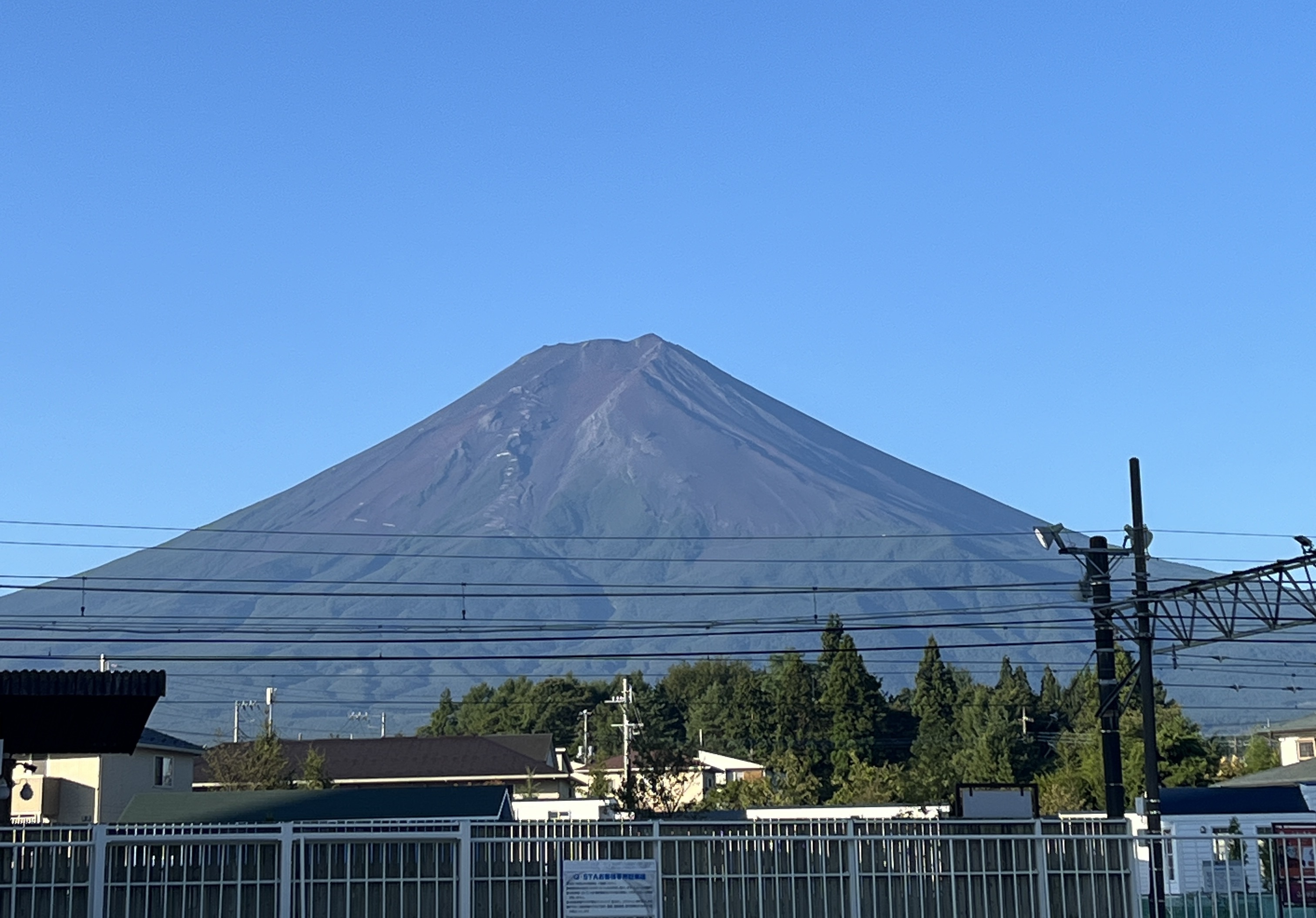
Mount Fuji is a stratovolcano that last erupted in 1707. It rises 3,776 meters from the surrounding plains of Yamanashi and Shizuoka prefectures and is visible from Tokyo on clear days—100 kilometers away.
For most of Japanese history, Fuji was not climbed. It was worshipped. The mountain was the residence of Konohanasakuya-hime, a Shinto goddess associated with flowers and the fragility of earthly life. Permanent settlement on the mountain was prohibited. The summit was accessible only to yamabushi—ascetic mountain monks who practiced a form of Buddhism blended with Shinto called Shugendo, for whom physical suffering in extreme environments was a deliberate spiritual tool.
The first recorded ascent by a non-monk is from 663 AD. Regular pilgrimages didn’t become common until the Edo period (17th–19th centuries), when Fuji-kō—religious confraternities organized specifically for Fuji pilgrimage—spread through Japanese merchant communities. Hundreds of thousands of pilgrims climbed the mountain in white robes, chanting sutras, carrying wooden staffs that received official stamps at each station.
The stamps still exist. The huts still sell them. When you have your wooden staff stamped at the 7th Station at 2 AM while trying to keep your headlamp from dying, you are doing exactly what Edo-period pilgrims did, and the gesture means the same thing it meant then: I have been this far. I have not given up.
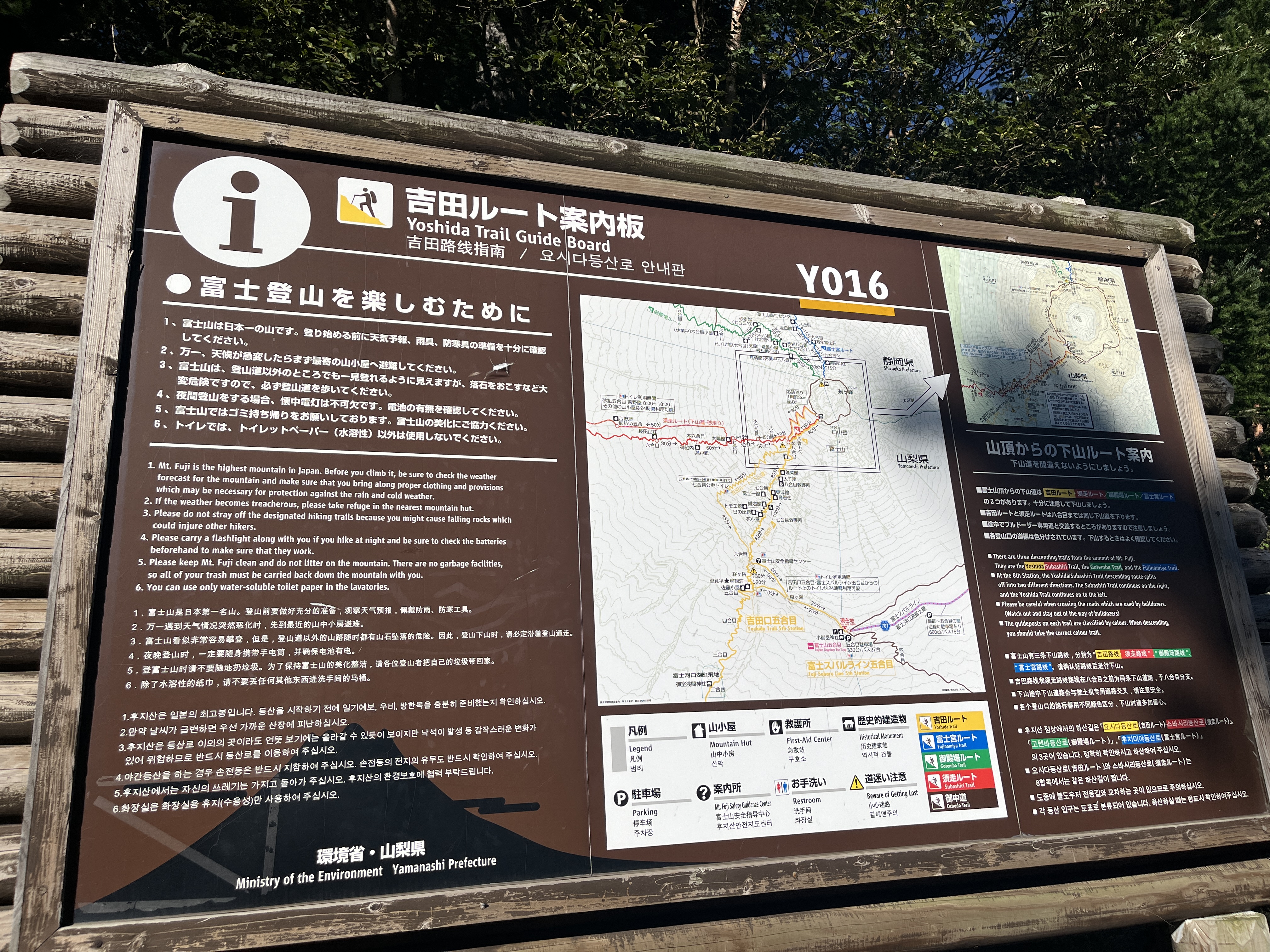
The Yoshida Trail: Why This Route and Not Others
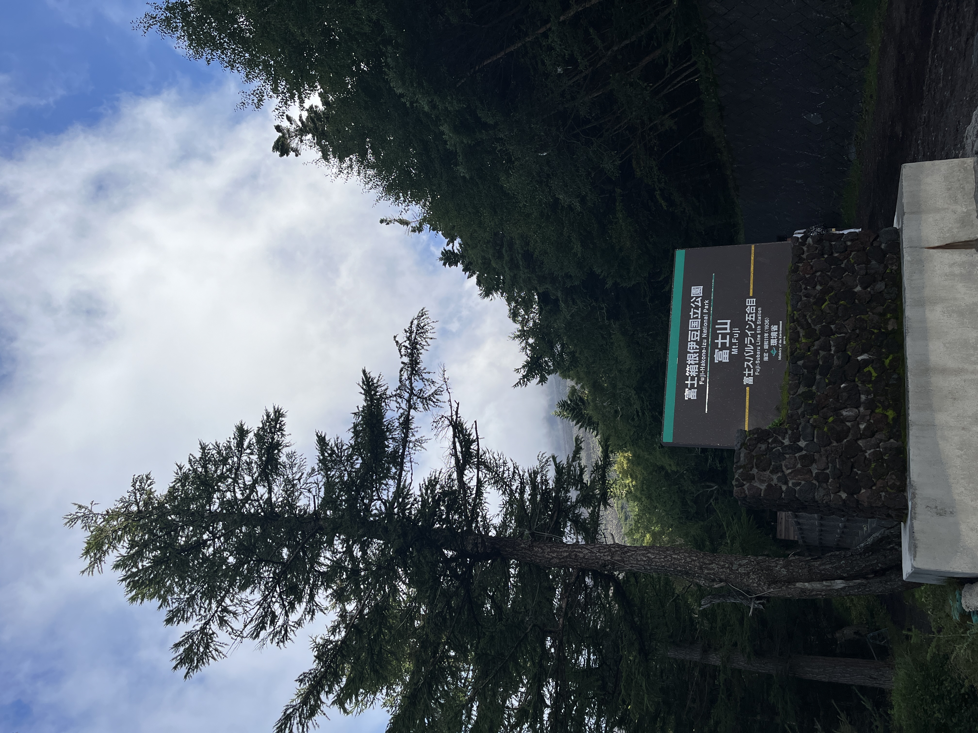
Mount Fuji has four major trails. The Yoshida Trail (吉田ルート), accessed from the Fuji Subaru Line 5th Station on the Yamanashi side, is the most historically significant and the most used—approximately 60% of all climbers take it.
Historical significance: The Yoshida trail begins, in its full form, at Fuji-Yoshida Sengen Shrine (富士山本宮浅間大社) at the mountain’s base—the major shrine historically associated with Fuji pilgrimage. The 5th Station, where most contemporary climbers begin, was historically the point at which the heavily forested lower slopes gave way to the volcanic rock of the upper mountain. Climbers began their ascent here.
Practical advantages: The Yoshida Trail has the highest concentration of yamagoya (mountain huts) of any route—over 20 operational huts between the 5th and 8th stations. This matters because: it provides the most opportunities to rest, warm up, buy water and food, and shelter from sudden weather changes. It is also the trail with the most extensive mountain rescue infrastructure.
The descent trail is separate: The Yoshida Trail uses a dedicated descent path (the Yoshida Osunabashiri, or “sand run”) that bypasses the ascent route. This prevents the traffic jam that would result from thousands of climbers going up and down the same narrow path simultaneously. The descent on loose volcanic sand is fast, hard on the knees, and requires good boots.
The Night Climb: Understanding Why You Do It in the Dark
The vast majority of climbers on the Yoshida Trail begin their ascent between 10 PM and midnight, timed to reach the summit before sunrise. This is called Goraiko (御来光)—the greeting of the first light.
This seems irrational until you understand what you’re actually doing.
The summit at dawn is cold—often below 0°C even in August, with wind chill making it feel significantly colder. The altitude reduces oxygen to roughly 60% of sea-level concentration. You have been climbing for 7–9 hours. Your legs are exhausted. The inside of your head feels strange in a way that suggests your blood oxygen is low enough to affect cognition.
And then the light comes.
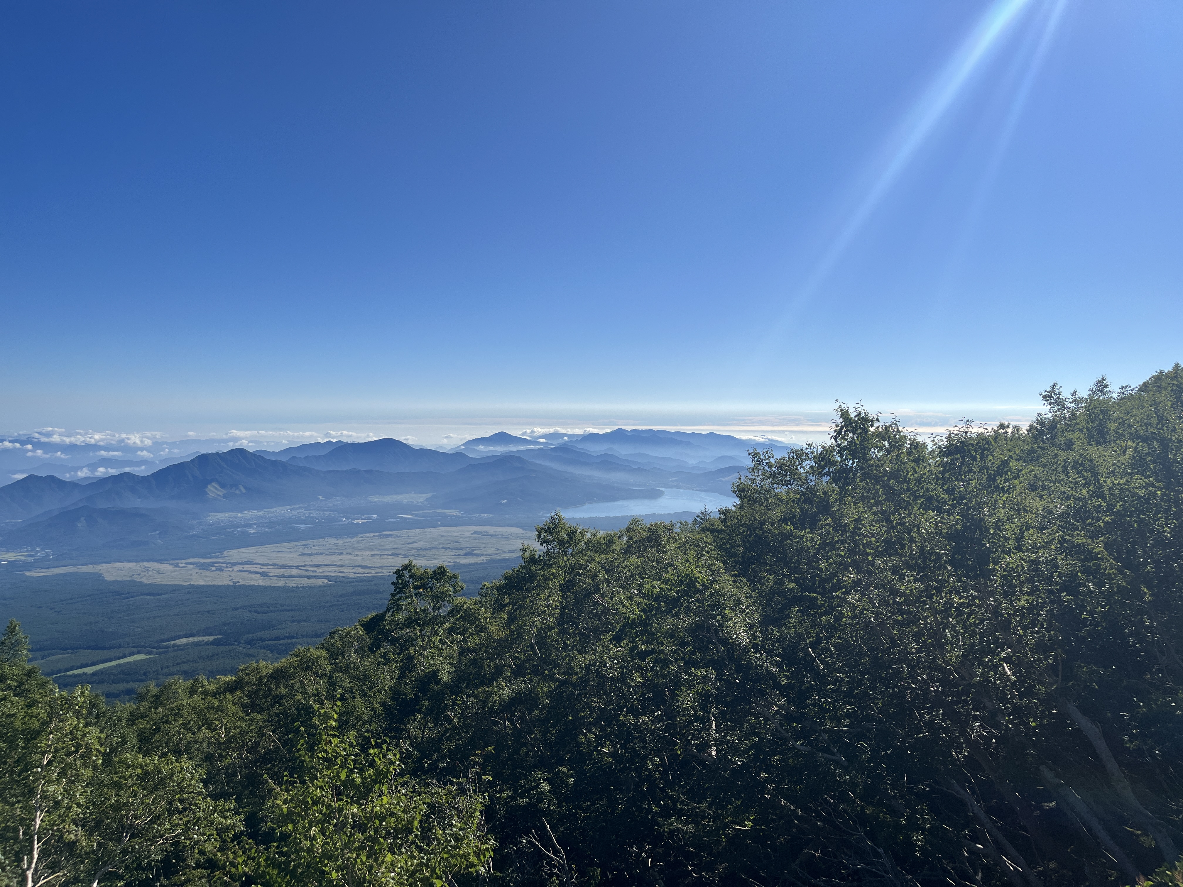
First, a deep blue that separates sky from land at the eastern horizon. Then a narrow orange line. Then, suddenly, the sun—rising over the clouds far below the summit, illuminating the ocean of cloud that covers the Kanto plain, catching the distant glint of Tokyo Bay. Japan, the entire country, is below you. The scale of what you’re standing on—a 3,776-meter cone rising from an archipelago in the Pacific—becomes fully physical in a way that no photograph can replicate.
Japanese climbers call this moment shintai no me ga sameru—“the body’s eyes open.” The exhaustion and cold and discomfort have prepared you to receive the view. If you drove to the summit (which is not possible, but hypothetically), you would not see the same thing. The suffering is the prerequisite.
The Climb: Stage by Stage
5th Station to 6th Station (~1 hour)
Starting elevation: 2,305 meters. The first section is through the remaining vegetation zone—sparse trees, then scrub, then rock. The path is wide and well-maintained. This is the acclimatization section: walk slowly, breathe deliberately, resist the instinct to set a fast pace that will exhaust you before the real climbing begins.
The 6th Station marks the transition from managed trail to open volcanic slope.
6th to 7th Station (~1 hour)
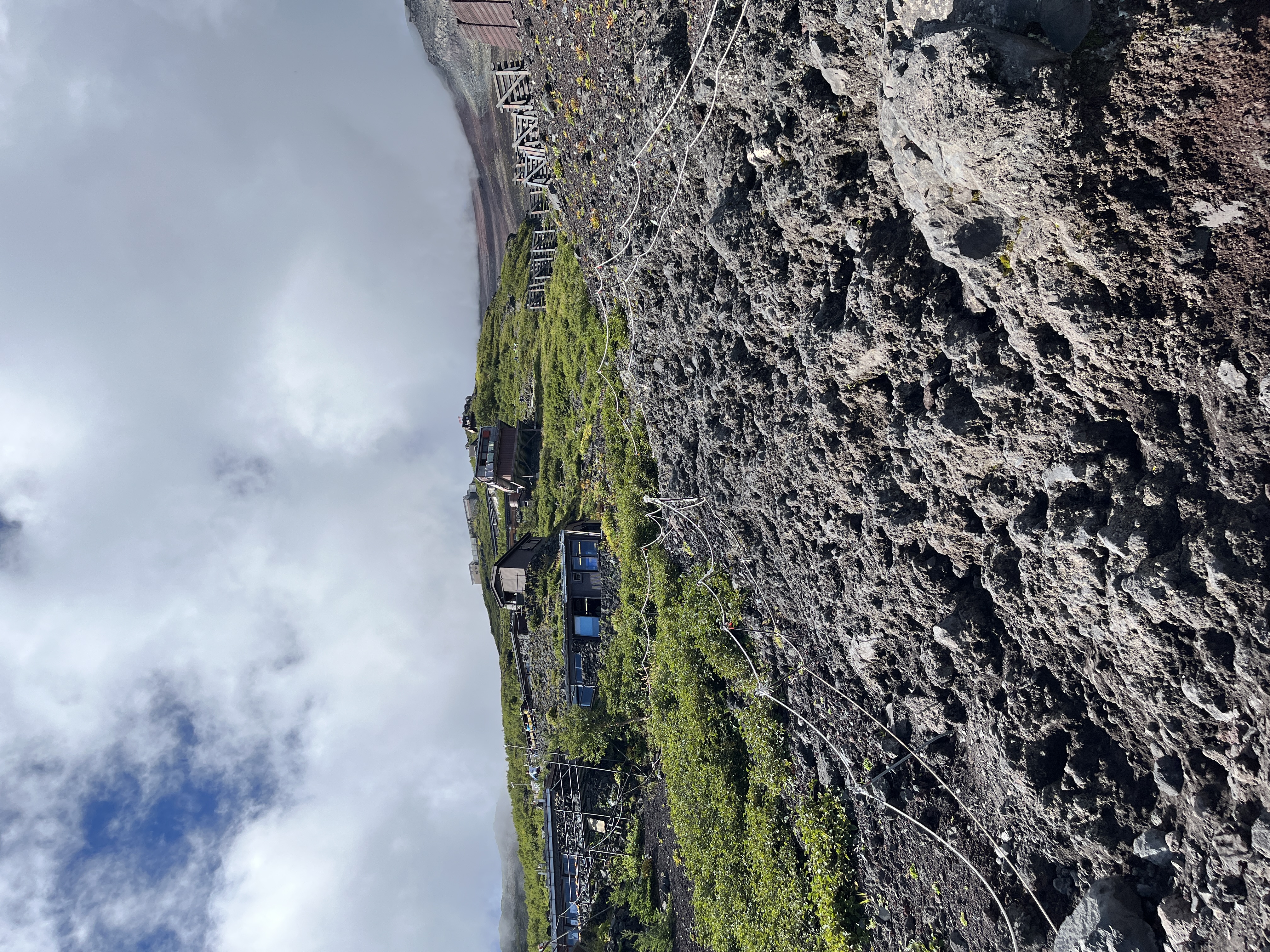
The gradient increases. The terrain is volcanic rock and cinder—loose, angular, requiring careful footing. The mountain huts at the 7th Station are the first place most climbers stop for a genuine rest and often their first meal since the base.
Altitude note: Most symptoms of kōzan-byō (高山病, altitude sickness)—headache, nausea, dizziness—begin to appear in this range. The correct response is: slow down, hydrate, wait for symptoms to stabilize before continuing. The incorrect response is to take pain medication and push through. Altitude sickness can become severe quickly and unpredictably.
7th to 8th Station (~2–3 hours)
The most challenging section. Steep switchbacks, rocky terrain requiring hands as well as feet in places. The mountain huts here—particularly around Taiyōkan and Tōmurozan—are where most climbers planning a summit sunrise spend the night.
If you can reserve a bunk in a mountain hut and sleep for 3–4 hours before the final push, do it. The ¥7,000–¥10,000 cost (usually including a meal) is worth it. You will summit in significantly better condition than climbers who did not sleep.
8th Station to Summit (~2 hours)
The torii gate visible from below marks the approach to the summit shrine. The final section is often walked in complete darkness, in a line of headlamps that stretches down the mountain for hundreds of meters. Keep moving. Keep your headlamp charged. Keep eating small amounts of high-calorie food.
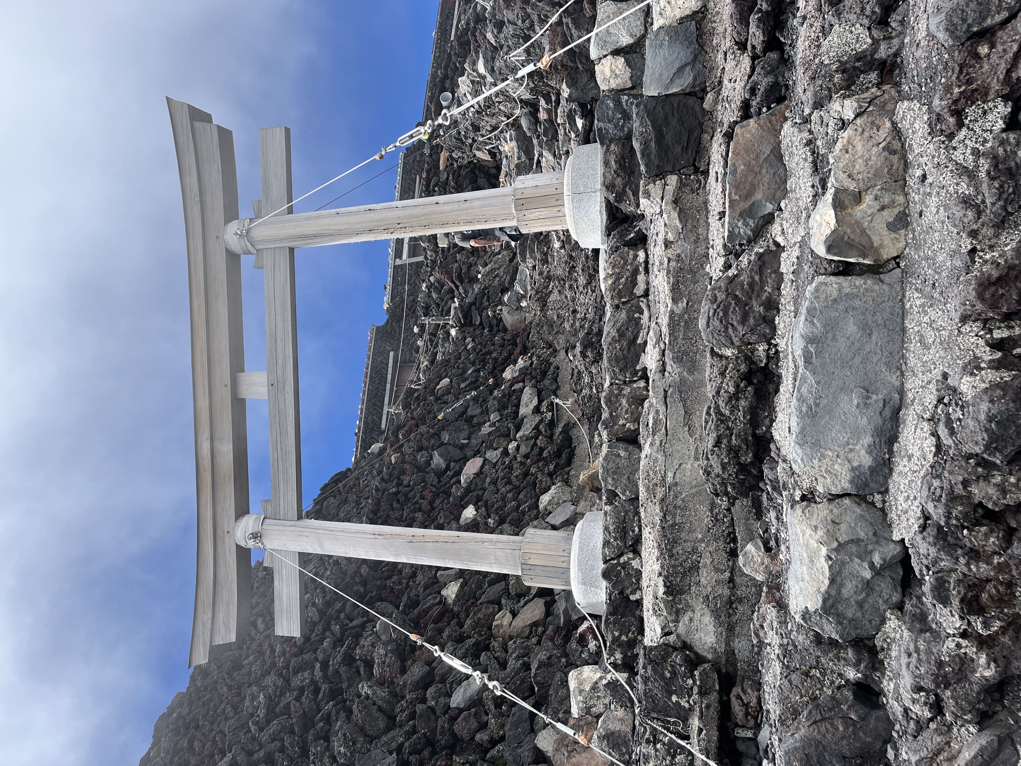
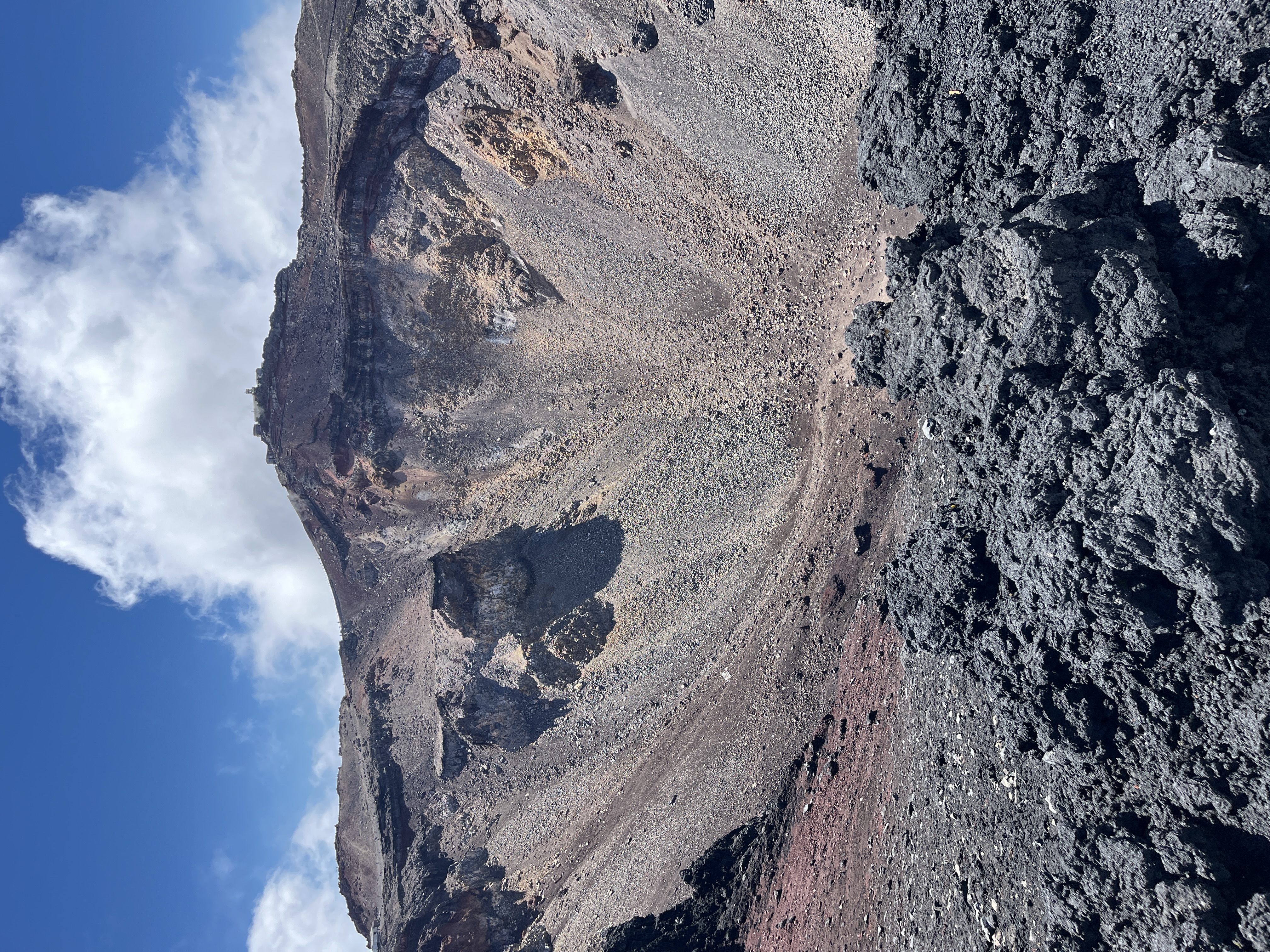
At the summit: the shrine, the weather station, a post office that has been operating at 3,776 meters since 1908 (from which you can send postcards with a special summit postmark), and the ohachi meguri—the walk around the crater rim (approximately 3 kilometers, 40 minutes).
What to Bring: The Non-Negotiables
Warmth: The temperature at the summit in August averages 6°C, and wind regularly drives the effective temperature below 0°C. Bring more than you think you need. Down jacket, windproof outer layer, gloves, wool hat.
Light: A quality headlamp with fresh batteries. The trail is not lit. Your headlamp is your trail.
Water: At minimum 2 liters from the base. Mountain huts sell water (¥400–¥500 per 500ml). This is expensive but the water is real and necessary.
Altitude medication: Speak to a physician before your trip. Acetazolamide (Diamox) is effective for altitude sickness prevention but requires a prescription in most countries and has side effects. Many Japanese mountain medicine guides recommend coca candy (available at drug stores near the 5th Station) as a mild preventive aid.
Cash: ¥5,000–¥10,000 minimum. The mountain is entirely cash-based.
A wooden Fuji staff: Sold at the 5th Station for approximately ¥1,000. Useful as a walking stick, meaningful as a record—each station stamps the staff for ¥200–¥300. At the end of the climb you have a physical artifact of where you were.
The Permit System and Environmental Responsibility
In response to significant overcrowding and environmental damage, Yamanashi Prefecture implemented a gate closure and entry fee at the Yoshida Trail entrance in 2024. As of 2025–2026:
- A barrier closes at 4 PM and reopens at 3 AM to prevent “bullet climbing” (ascending without overnight preparation)
- A ¥2,000 conservation fee is charged per person at the 5th Station
- Daily climber caps of 4,000 people per day are enforced
These restrictions are correct and necessary. The mountain’s volcanic soil is fragile and slow to recover from the damage caused by 300,000+ annual climbers. The permit system is part of Japan’s longer-term effort to balance access with preservation.
Book mountain huts early, comply with the gate schedule, and carry out all your trash. The mountain has existed for 700,000 years. We are borrowing it.
The Descent: Harder Than You Think
Most climbers underestimate the descent. Going down 1,476 meters of volcanic slope on tired legs, with altitude-depleted cognition and potentially blistered feet, takes 3–5 hours and significantly stresses the knees.
Trekking poles are more useful on the descent than the ascent. Take them, use them, and descend slowly enough that you don’t fall.
The Yoshida Osunabashiri (descent trail) runs on loose volcanic sand that makes descent much faster than ascent—almost like running in slow motion. This is fun for the first 500 meters and not fun for the following 1,000.
Practical Information
- Climbing season: Early July to early September (facilities open; trail clear of snow)
- 5th Station access: Highway buses from Shinjuku Station; approximately 2.5 hours; advance booking essential in peak season
- Conservation fee: ¥2,000 per person at the Yoshida Trail entrance
- Gate hours: Opens 3 AM, closes 4 PM daily during climbing season
- Mountain hut booking: Via official Mt. Fuji mountain hut websites; book 1–2 months ahead for peak season
“A fool climbs Fuji once” is accurate. What it doesn’t say is why it’s worth being that fool, at least once—standing at 3,776 meters in the grey pre-dawn cold, watching the sun come up over a country that built this shrine and stamped these staffs and made this offering to the mountain for 1,200 years before you arrived. There is no viewpoint in Japan that teaches you more about scale—geographic and historical—than the top of Fuji at sunrise.